Showing posts with label David Rumsey Historical Map Collection. Show all posts

Monday, July 2, 2018

Monday Is for Mothers: Polly Williams (? - ?)

This paternal fourth great grandmother is one of my brick walls. The only time we've found her name is this record of her marriage to Barnabeth Herod in 1796 in from Davidson County, Tennessee.*

[Year: 1789 - 1971: Marriages. Ancestry.com. Tennessee, Marriage Records, 1780-2002 [database on-line]. Lehi, UT, USA: Ancestry.com Operations Inc, 2008. Original data: Tennessee State Marriages, 1780-2002. Nashville, TN, USA: Tennessee State Library and Archives. Microfilm.]


Here's the line of descent from Polly to me:

[Ancestry.com]

Of course it's entirely possible that Polly Williams isn't my ancestor--since we don't know her death date, Barnabas could be the son of a second wife of Barnabeth's whose name isn't recorded at all.


*Davidson County is centered on Nashville. Here's an 1795 map of Tennessee with the location of Nashville highlighted:

[Map of The Tennassee [sic] State. - David Rumsey Historical Map Collection]


© 2018 Copyright, Christine Manczuk, All Rights Reserved.

Monday, May 21, 2018

My Great Grandparents Visited the St. Louis World's Fair - 1904

St. Louis celebrated the centennial of the Louisiana Purchase by hosting an international exposition* which was officially opened by President Theodore Roosevelt on April 30, 1904.**
[1904 Louisiana Purchase Exposition poster showing area covered by the purchase-image found at Porter Briggs.com]

Before it closed on December 1st, nearly 19.7 million people visited the site, including my great grandparents Lewis Logan Slater and Rufina Ellen Tomlinson accompanied by their 14-year old daughter Opal
[13 Oct 1904, 8 - Democratic Messenger at Newspapers.com]

Since the railroad line goes right through Severy I'm sure they traveled to St. Louis by train.

[Kansas railroad map - Kansas Memory. Kansas Historical Society]

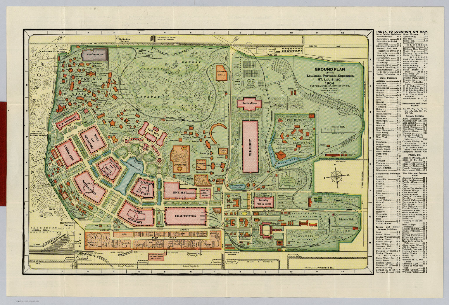
The Exposition fairgrounds sprawled over 1,270 acres:

[Panoramic aerial view of the Louisiana Purchase Exposition (St. Louis World's Fair) held in St. Louis, Missouri, from April 30 to December 1, 1904. View was probably made from a tethered balloon at the Aeronautic Concourse in the northwest corner of the fairgrounds, looking roughly southwest. Source: Smithsonian National Air and Space Museum]

[Ground Plan Of The Louisiana Purchase Exposition St. Louis, Mo. 1904. Buxton & Skinner Stationery Co. Publishers, Fourth & Olive St. St. Louis, Mo. Copyright, 1904 By Parker Eng. Co. Source: Davis Rumsey Historical Map Collection]


This daily program for the Exposition dates from a few days before the Slaters arrived, but it gives us an idea of the kind of event to be seen by visitors.

[An Official Daily Program from the 1904 Louisiana Purchase Exposition for Saturday, October 8th

[Order of the day from an Official Daily Program from the 1904 Louisiana Purchase Exposition for Saturday, October 8th

I wonder if they brought home one of these?***

[Souvenir book of the Louisiana Purchase Exposition, © 2017 The Wolfsonian—Florida International University]


*Here's a French poster:

[Poster for the Louisiana Purchase Exposition, informally known as the St. Louis World's Fair, painted by artist Alphonse Mucha.
Wikimedia Commons]

**And a bust of President Roosevelt sculpted in butter was a featured exhibit.

[Library of Congress Prints and Photographs Division Washington, D.C. 20540 USA
http://hdl.loc.gov/loc.pnp/pp.print]


© 2018 Copyright, Christine Manczuk, All Rights Reserved.